
Find research datasets worth reusing
Search datasets from major research repositories and use ShareScore to quickly assess how well each record supports discovery, access, and reuse.
12,237
datasets available to search
ShareScore release 0.9.0
Dataset results
12,237 results for “2019”
2019 SCOPE Gradients Downcast CTD Data
<p>This dataset contains water column data collected via CTD profiles taken on the SCOPE Gradients 3 (KM1906) oceanographic research cruise in the Northeast Pacific Ocean. These data were collected on the CTD downcast. The SCOPE-Gradients program is designed to test conceptual and mathematical models of biogeochemical organization across the transition zone between different ecosystems.</p>
Preserved Specimen Records with Still Images Registered Across Biodiversity Data Networks in Period 2019-2022 hash://sha256/da7450941e7179c973a2fe1127718541bca6ccafe0e4e2bfb7f7ca9dbb7adb86
<p>Natural History Collections keep physical specimen of organisms. Some of these collections provide digital catalogs. These digital catalogs may be registered with, and tracked by, digital registries like Global Biodiversity Information Facility (GBIF, https://gbif.org), Integrated Digitized Biocollections (iDigBio, https://idigbio.org), and the Biological Collection Access Service (BioCASe, https://biocase.org).</p> <p>This publication reports on the availability of registered preserved specimen records with at least one associated image (i.e. StillImage) over period 2019/2022. </p> <p>For a description of the methods, see:</p> <p>Jorrit Poelen. (2022). jhpoelen/specimen-image-index: 0.0.1 (0.0.1). Zenodo. https://doi.org/10.5281/zenodo.7032668</p> <p>The associated provenance log identifiers include:</p> <p>hash://sha256/251fa349c051bbda370decb7e5e58960d702add59f6e131ebf7c960d0f93b417<br> hash://sha256/261177a96185166f1c301beacf7350abff03d1b5710be6bfd8c4aff9caffef12<br> hash://sha256/8ff46ae6a30bf9647df0294b92434a83784626b3f8c37163db3edefb049daead<br> hash://sha256/9a41d2583f0b8169ffdd44fb2d3a5e057eba4a10e5d9193d0c6e9dcf07c3119e<br> hash://sha256/b9864a749112cad2fe19e62bf5d8bad580a7036d363d16d81d5c16be325fa0fd<br> hash://sha256/da7450941e7179c973a2fe1127718541bca6ccafe0e4e2bfb7f7ca9dbb7adb86</p> <p>where the hash://sha256/da7450941e7179c973a2fe1127718541bca6ccafe0e4e2bfb7f7ca9dbb7adb86 is cryptographically linked to the others. </p> <p>For completeness, the associated provenance logs are included using their hex hashes as file attached to this publication:</p> <p>251fa349c051bbda370decb7e5e58960d702add59f6e131ebf7c960d0f93b417<br> 261177a96185166f1c301beacf7350abff03d1b5710be6bfd8c4aff9caffef12<br> 8ff46ae6a30bf9647df0294b92434a83784626b3f8c37163db3edefb049daead<br> 9a41d2583f0b8169ffdd44fb2d3a5e057eba4a10e5d9193d0c6e9dcf07c3119e<br> b9864a749112cad2fe19e62bf5d8bad580a7036d363d16d81d5c16be325fa0fd<br> da7450941e7179c973a2fe1127718541bca6ccafe0e4e2bfb7f7ca9dbb7adb86</p> <p>Other files include, suffixed by the first four hex characters of their associated provenance log id:</p> <p># this file <br> README</p> <p># identifiers of tracked content captured in associated provenance logs.<br> content_251f.tsv<br> content_2611.tsv<br> content_8ff4.tsv<br> content_9a41.tsv<br> content_b986.tsv<br> content_da74.tsv</p> <p># identifiers of tracked content said to contain multimedia<br> content-with-multimedia_251f.tsv<br> content-with-multimedia_2611.tsv<br> content-with-multimedia_8ff4.tsv<br> content-with-multimedia_9a41.tsv<br> content-with-multimedia_b986.tsv<br> content-with-multimedia_da74.tsv</p> <p># identifiers of tracked content said to contain multimedia and still images<br> content-with-still-images_251f.tsv<br> content-with-still-images_2611.tsv<br> content-with-still-images_8ff4.tsv<br> content-with-still-images_9a41.tsv<br> content-with-still-images_b986.tsv<br> content-with-still-images_da74.tsv</p> <p># identifiers of tracked content said to contain multimedia, still images, and specimen<br> content-with-still-images-and-specimen_251f.tsv<br> content-with-still-images-and-specimen_2611.tsv<br> content-with-still-images-and-specimen_8ff4.tsv<br> content-with-still-images-and-specimen_9a41.tsv<br> content-with-still-images-and-specimen_b986.tsv<br> content-with-still-images-and-specimen_da74.tsv</p> <p># reported scientificName associated with preserved specimen record with image(s)<br> content-name-image_251f.tsv.gz<br> content-name-image_2611.tsv.gz<br> content-name-image_8ff4.tsv.gz<br> content-name-image_9a41.tsv.gz<br> content-name-image_b986.tsv.gz<br> content-name-image_da74.tsv.gz</p> <p># names associated with preserved specimen with images grouped in categories Plantae, Insecta and Mammalia</p> <p>plantae_insecta_or_mammalia_image_251f.tsv.gz<br> plantae_insecta_or_mammalia_image_2611.tsv.gz<br> plantae_insecta_or_mammalia_image_8ff4.tsv.gz<br> plantae_insecta_or_mammalia_image_9a41.tsv.gz<br> plantae_insecta_or_mammalia_image_b986.tsv.gz<br> plantae_insecta_or_mammalia_image_da74.tsv.gz</p> <p># associated discussions</p> <p>github_bio-guoda_preston_issues_168-2022-08-29.txt<br> github_jhpoelen_specimen-image-index_issues_1-2022-08-29.txt</p> <p># associated processing scripts</p> <p>make-all.sh<br> make.sh<br> has-multimedia.sh<br> extract-still-image-records.sh<br> has-still-image.sh<br> extract-preserved-specimen-records.sh<br> has-specimen.sh<br> create-named-specimen-with-image-table.sh</p>
Drone aerial imagery of a macroalgal-covered coastline in Kobbefjord (SW Greenland) in 2018 and 2019
<p>Aerial images of inner Kobbefjord (SW Greenland) were acquired on two occasions in 2018 (2018-09-07 15:06; 2018-09-07 16:00) representing different tidal levels and on one occasion in 2019 (2019-08-26). Images were acquired using a DJI Mavic Air drone. The imagery was acquired in connection with the “Greenland Ecosystem Monitoring Program” “Nuuk Basis” monitoring of marine flora (http://<a href="http://g-e-m.dk/">g-e-m.dk</a>/). This drone survey was carried out with the primary goal of documenting and quantifying the area distribution of the tidal vegetation (dominated by the brown macroalga <em>Ascophyllum nodosum</em>) and shallow subtidal vegetation at the monitoring site. Images were processed using Agisoft Metashape Professional to produce high resolution orthomosaics from each UAV survey.</p>
IEA 2020 TIMSS 2019 (Example items, highlighted Portugal) International Results in Mathematics and Science
<p>IEA 2020 TIMSS 2019 (Example items, highlighted Portugal) International Results in Mathematics and Science</p> <p>Grades 4 and 8, Mathematics and Science</p>
CLDF dataset derived from Tang and Her's "Quantitative typological data on classifiers and plural markers" from 2019
<p><strong>Tang, Marc and One-Soon Her. 2019. Insights on the Greenberg-Sanches-Slobin Generalization: Quantitative typological data on classifiers and plural markers. Folia Linguistica, 53(2): 297-331. https://doi.org/10.1515/flin-2019-2013.</strong></p>
Observed water level from 2015 to 2019 in 4 wells from a porous fractured aquifer in Burgundy, France
<p>This repository hosts the data used for drawing figure 8 from Jeannot et al.(submitted). The dataset is made of observed water levels from 2015 to 2019 in 4 wells from a porous fractured aquifer in Burgundy, France. The sampling time step is 2 hours.</p> <p><strong>Cited bibliography</strong></p> <p>Jeannot, B., Schaper, L., and Habets, F., submitted. Water Level in Observation Wells Simulated from Fracture and Matrix Water Heads Outputed by Dual-continuum Hydrogeological Models : POWeR-FADS. <em>Water Resources research</em></p>
Data for continuous and discrete measurements of carbonate parameters in a productive coastal region in the Northwestern Pacific (36°09'13.5''N, 129°24'04.9''E) from January to September in 2019 and from March to December in 2020
<p><span>Photosynthetic organisms shift the dynamics of surface pCO<sub>2</sub> driven by the sea surface temperature change (thermodynamic driver) by assimilating C from seawater. Here we measured net C uptake </span><span>in a macroalgal habitat</span> <span>of coastal Korea for two years (2019–2020) and found that the macroalgal habitat</span> <span>contributed </span><span>5.8 g</span><span> C m</span><sup><span>-</span><span>2</span></sup><span> month</span><sup><span>-</span><span>1</span></sup><span> of </span><span>the net C uptake during the growing period (the cooling period, September</span><span>-</span><span>May). This massive C uptake changed the thermodynamics-driven seasonal dynamics such that the air</span><span>-</span><span>sea equilibrium of </span><span>pCO<sub>2</sub></span><span> was pushed into disequilibrium. T</span><span>he </span><span>surface </span><span>pCO<sub>2</sub></span><span> dynamics during the cooling period were </span><span>mostly influenced by the seasonal decrease in temperature and the proliferation of macroalgae, while the dynamics </span><span>during the warming period </span><span>(the stagnant period, </span><span>June</span><span>-</span><span>August) </span><span>closely followed that predicted based solely on the change in sea surface temperature only </span><span>(thermodynamic driver)</span><span>.</span><span> In contrast to the phytoplankton-dominated offshore waters (where phytoplankton populations are large in spring and summer), the impact of coastal water macroalgae on surface </span><span>pCO<sub>2</sub></span><span> dynamics was most pronounced during the cooling period, when the magnitude of </span><span>pCO<sub>2</sub></span><span> change was as much as twice that resulting from temperature change. Our study shows that</span><span> t</span><span>he distinctive features of the macroalgal habitat—in particular the seasonal temperature extremes (~18°C difference), the </span><span>active macroalgal metabolism,</span><span> and anthropogenic </span><span>nutrient</span><span> inputs—collectively influenced</span><span> the seasonal decoupling of seawater and air </span><span>pCO<sub>2</sub></span><span> dynamics</span><span>.</span></p>
TARP 2019: SU 2044, SU 2046, SU 2047
Photogrammetric capture of stratigraphic units 2044, 2046, and 2047. Source: Objaverse 1.0 / Sketchfab
Molino San Vincenzo O4/S5/2018–2019: garbage pit
[Roman Rural Landscapes at the Department of Classical Archaeology, University of Vienna](http://rrl.univie.ac.at/) # 3D model of ***O4/S5/2018–2019*** of trench 5/2018–2019 at the rural site at [Molino San Vincenzo (Tuscany/ITA)](http://bit.ly/msv-gm) which has been recognized as rubbish pit filled with garbage from an Etruscan phase at the site. The model shows all recorded layers of object 4 according to their stratigraphic sequence. Each layer is linked to another model on Sketchfab – have a look at the annotations! # 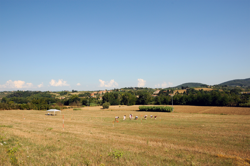 # Molino San Vincenzo is an ancient rural site near the village San Vincenzo a Torri in the municipality of Montespertoli in Tuscany/Italy. # ____ # Learn more about the site at [our website](https://rrl.univie.ac.at/forschung/msv) # *** [view the collection of O4's artefacts at Sketchfab](https://sketchfab.com/dominik.hagmann/collections/molino-san-vincenzo-artefacts-of-o4-in-trench-5) Source: Objaverse 1.0 / Sketchfab
Christmas 2019
Merry Christmas and all the best for the new year. This model is dedicated to all people who have to experience suffering and war. It is Christmas 2019. Source: Objaverse 1.0 / Sketchfab
Sopley Evaluation Trench 30th Nov 2019
Evaluation trench of a possible long barrow being dug by Avon Valley Archaeological Society (AVAS) and the Christchurch Antiquarians (TCA) Source: Objaverse 1.0 / Sketchfab
2019-10 - Hangzhou 16
53 Photos taken with a Camera SONY Alpha 7 (RAW), then processed with Agisoft Photoscan Source: Objaverse 1.0 / Sketchfab
Aldborough 2019
Archaeological excavations Roman Aldborough May 2019. Photogrammetric model generated using Agisoft Metashape Pro from over 200 photographs taken using a tripod mounted Sigma DP0 Quattro camera. This camera employs a Foveon Sensor which has exceptional colour rendering properties ideal for documenting the subtle colour variations frequently experienced in archaeological deposits. Source: Objaverse 1.0 / Sketchfab
London Roman Wall Alphage Garden 2019
A section of Roman and Medieval wall at Alphage Garden, (near Fore St) London. https://historicengland.org.uk/listing/the-list/list-entry/1018886 I also produced a version of this model in 2013 before the area was redeveloped: https://skfb.ly/6OAMO 868 photos taken in November 2019 with a Sony a6000 and processed in Agisoft Metashape. Source: Objaverse 1.0 / Sketchfab
Chantier INRAP rue Blaise-pascal, Rouen, 2019
Chantier INRAP rue Blaise-pascal, Rouen, 2019 Responsable d'opérations Paola Calderoni Source: Objaverse 1.0 / Sketchfab
3D Inktober 2019: Dragon
Based on "Dragon" by Cédric Villain from the Noun Project: https://tinyurl.com/yyg4vv4e Chinese Clouds Vectors by Vecteezy: https://tinyurl.com/y2hdd7rm Join 3D Inktober 2019: https://tinyurl.com/yxj5bovb Tools: Blender Source: Objaverse 1.0 / Sketchfab
Ouse and Derwent Project 2019 - Trench 2
Trench 2 at Wheldrake revealed one small and two very large linear features. In the end we didn't have time to excavate these, but they confirmed the geophysical survey results -- these features are the enclosure ditches surrounding the round-house settlement. The [Ouse and Derwent Project](https://www.facebook.com/IAOuseandDerwent/) is a three year community project examining the Iron Age landscape in the Vale of York. It is funded by a grant from the Heritage Lottery Fund. Source: Objaverse 1.0 / Sketchfab
2019-10 - Hangzhou 06
62 Photos taken with a Camera SONY Alpha 7 (RAW), then processed with Agisoft Photoscan Source: Objaverse 1.0 / Sketchfab
Guerrero Aqua Glass (2019)
A fragment of aqua-colored glass as it was found underwater in 2019 on the shipwreck site 2-04/8MO02343, thought to be that of the 1827 pirate slave ship *Guerrero*. This type of glass matches other examples seen previously on the site. Scale = 5 centimeters. Source: Objaverse 1.0 / Sketchfab
Damage cadasters for wildland-urban interface fires in Chile, 2019-2022
<p><span>Wildland-urban interface (WUI) regions are particularly vulnerable to wildfires due to their proximity to both nature and urban developments, posing significant risks to lives and property. To enhance our understanding of the risk profiles in WUI areas, we analysed seven fire case studies in central Chile. </span></p> <p><span>In the paper <em>"</em><span><em>Modelling the vulnerability of urban settings to WUI fires in Chile",</em> </span>We developed a mixed-methods approach for conducting local-scale analyses which involved field surveys, remote-sensing through satellite and drone imagery, and GIS-based analysis of the collected data. The methodology led to the generation of a georeferenced dataset of damaged and undamaged dwellings, including 16 variables representing their physical characteristics, spatial arrangement, and the availability of fire suppression resources. A binary classification model was then used to assess the relative importance of these attributes as indicators of vulnerability. The analysis revealed that spatial arrangement factors have a greater impact on damage prediction than the structural conditions and fire preparedness of individual units. Specifically, factors such as dwelling proximity to neighbours, distance to vegetation, proximity to the border of dwelling groups, and distance from the origin of the fire substantially contribute to the prediction of fire damage. Other structural attributes associated with less affluent homes may also increase the likelihood of damage, although further data is required for confirmation. This study provides insights for the design, planning, and governance of WUI areas in Chile, aiding the development of risk mitigation strategies for both built structures and the broader territorial area.</span></p>
ScienceDex guides
Understand access before you commit
These curated guides explain access requirements, typical timelines, costs, and reuse considerations for widely used research datasets.
Allen Brain Atlas
Allen Brain Atlas is an Allen Institute collection of brain map atlases, datasets, APIs, and analysis tools covering mouse, human, and non-human primate brain resources.
Annotated Behaviour and Observability Dataset (ABODe)
ABODe is a University of Edinburgh DataShare dataset for behavior classification in group-housed mice using home-cage video, identities, bounding boxes, ground-plate positions, and annotator labels.
DANDI Archive for NWB datasets
DANDI is a BRAIN Initiative archive for publishing and sharing neurophysiology data, including electrophysiology, optophysiology, and behavioral data packaged as NWB and related standards.
International Brain Laboratory public data
The International Brain Laboratory public data releases expose standardized mouse decision-making experiments, including Neuropixels recordings, widefield calcium imaging, behavior, and session metadata accessed through the ONE API.
OpenNeuro
OpenNeuro is a free, open platform for sharing neuroimaging datasets, with public search, dataset pages, and download paths for web, S3, DataLad, and the OpenNeuro CLI.